Wind From Hermine Increasing On Southeast Coast
CARRABELLE, Fla. (AP) — The Latest on Hermine (all times local):
8:15 a.m.
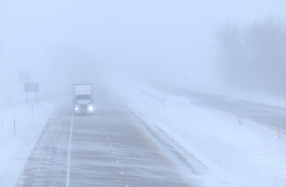
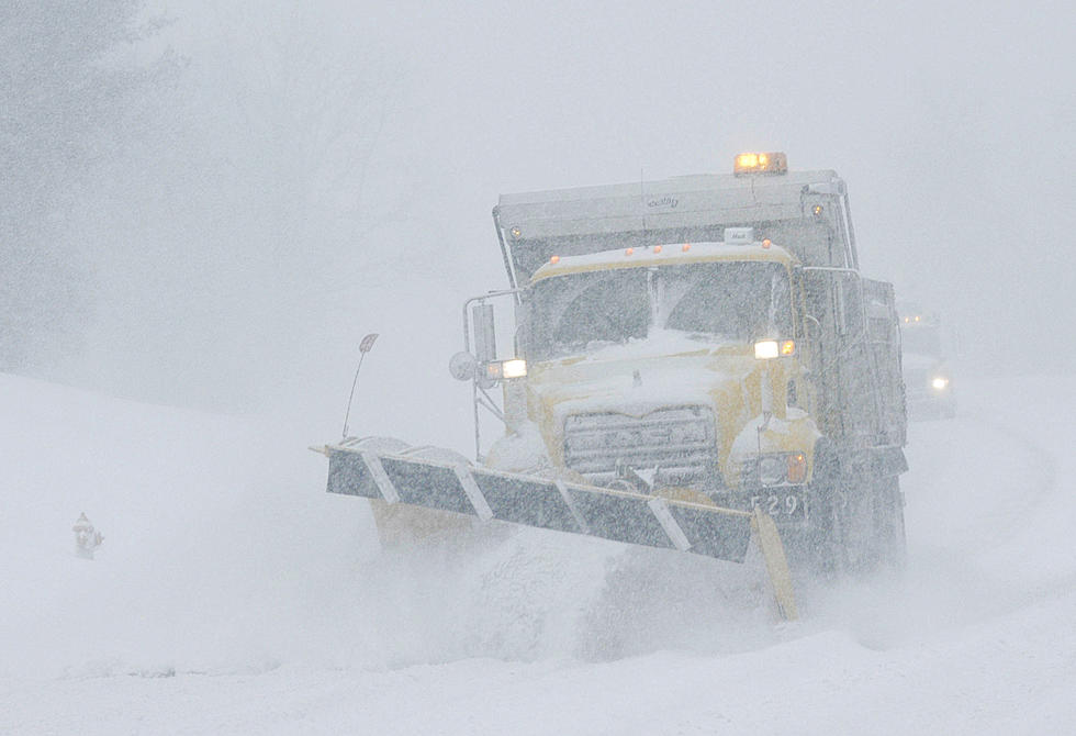
Hermine is getting weaker as it moves over Georgia, but the U.S. National Hurricane Center says winds are increasing along the Southeast coast and flooding rains continue.
The tropical storm's maximum sustained winds have decreased to near 60 mph with additional weakening forecast while Hermine stays over land.
As of 8 a.m. EDT Friday, Hermine was centered about 35 miles northeast of Valdosta, Georgia, and moving north-northeast near 14 mph.
Hermine was the first hurricane to hit Florida in more than a decade when it came ashore early Friday as a Category 1 storm.
After pushing into Georgia, Hermine is expected to move into the Carolinas and up the East Coast with the potential for drenching rain and deadly flooding.
___
8:15 a.m.
Taylor County Commissioner Jody DeVane says Tropical Storm Hermine left lots of property damage in the community in Florida's Big Bend area.
But DeVane says there were no reports of major injuries. He says about two dozen people waited along a road to access their properties at Keaton Beach early Friday morning. Police had blocked the road and wouldn't let anyone through.
Cindy Simpson wore a yellow rain jacket and shorts as she waited to see if her beach home and boats had made it through the storm. She says her home sits on stilts, so she put "everything upstairs" to keep it safe from flooding. She says she hopes the two boats in their boathouse are still safe.
___
8:15 a.m.
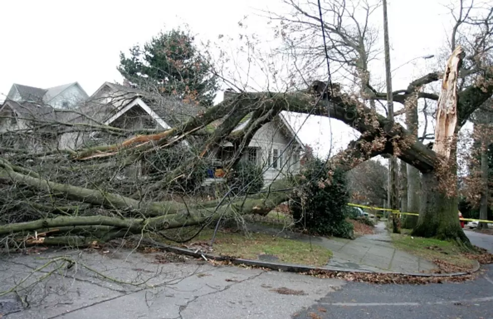
Fire rescue officials in Tallahassee say high winds knocked trees onto several houses injuring residents inside.
Spokesman Mike Bellamy tells The Associated Press that several people were taken to area hospitals with injuries that weren't thought to be life-threatening as the storm passed across the Tallahassee area early Friday.
Bellamy says his agency responded to more than 300 calls overnight.
He says there are power lines down, and many people are still without electricity in their homes. The area had winds of about 64 mph and 4 to 5 inches of rain.
___
7:20 a.m.
Heavy rains from Tropical Storm Hermine have moved into the Carolinas.
Virtually all of South Carolina is under some sort of weather warning - tropical storm warnings near the coast to high wind warnings farther inland. Flash flood watches are posted everywhere except the state's far northwest corner.
Strong thunderstorms moved through Charleston early Friday although no downtown streets were immediately closed because of flooding. Scattered power outages were reported around the state.
Forecasters at the National Weather Service in Charleston say the flood threat has eased a bit and about 3 to 5 inches of rain are forecast - down from as much as 10 inches predicted a day earlier.
The center of Hermine is expected to move roughly along Interstate 95 through South Carolina through the day Friday.
Hermine made landfall in Florida early Friday as a Category 1 hurricane.
____
7:05 a.m.
Tallahassee Mayor Andrew Gillum says power outages are "pretty ubiquitous" and that three-quarters of the city customers didn't have electricity following Hurricane Hermine ripping though the city in the early morning hours Friday.
Gillum estimated as many as 100,000 local residents are without electricity, including 70,000 city customers.
Gillum was not aware of any major damages or serious injuries in Florida's capital city although he stressed reconnaissance crews had just started venturing out.
He said the storm also downed trees, leaving many major streets blocked.
____
6:45 a.m.
Outer bands from Tropical Storm Hermine continue to dump large amounts of rain across the Tampa Bay area.
Meteorologist Daniel Noah of the National Weather Service in Tampa says the rain should start slowing by Friday afternoon.
But the rain caused flooding in many areas of Tampa, St. Petersburg and coastal regions in Pinellas and Pasco counties. Law enforcement authorities are warning people to be extremely cautious while driving due to flooded roads and possible downed trees and power lines.
Noah says that over the past 72 hours, the Tampa Bay area has seen sign significant rainfall. An area west of Oldsmar in Pinellas County recorded 22.36 inches of rain while in nearby Largo some 15.23 inches of rain has fallen. Other rain totals include 10.73 inches in Seminole, 9.71 inches in Longboat Key and 8.61 inches in Port Richey.
____
6:30 a.m.
Georgia Power reports that more than 30,000 of its customers were without power shortly before dawn Friday as Hermine rolls across the southern section of the state.
Georgia Power's online outage map showed that many of the outages were in and around the cities of Valdosta and Brunswick.
In the Valdosta area, Lowndes County spokeswoman Paige Dukes said crews were dealing with fallen trees and snapped power lines, but no injuries had been reported. She says winds exceeding 55 mph had been recorded in the county, with 4 to 5 inches of rainfall.
Hermine was moving north-northeast across south Georgia at 14 mph toward Savannah on the coast.
___
6 a.m.
A couple suffered minor injuries during Hurricane Hermine when they drove into a downed tree along the coast of the Florida Panhandle.
Wakulla County Administrator Dustin Hinkel said Friday that the couple was driving during the storm and drove into a tree that had fallen into the road.
He said storm surge of 8 to 10 feet hit the county's beaches, damaging docks and flooding coastal roads in the county that's south of Tallahassee.
___
5:25 a.m.
Authorities in Florida's Pasco County say coastal flooding has forced at least 18 people from their homes in Green Key and Hudson Beach as rain from Hermine drenches the state.
Early Friday morning, Pasco County Fire Rescue and sheriff's deputies used high-water vehicles to rescue people from rising water. They were taken to a nearby shelter.
The sheriff's office said in a news release that storm surge from the Gulf of Mexico, combined with intermittent bands of heavy rain, pushed water into low-lying neighborhoods.
Many roads in the area north of Tampa, are also flooded.
___
4:50 a.m.
Hermine has weakened to a tropical storm as it moves farther inland after making landfall in Florida's Big Bend area as a hurricane.
The U.S. National Hurricane Center says the storm's maximum sustained winds have decreased to near 70 mph with additional weakening forecast.
The storm is centered about 20 miles west of Valdosta, Georgia, and is moving north-northeast near 14 mph.
Hermine was the first hurricane to hit Florida in more than a decade when it came ashore early Friday.
After pushing into Georgia, Hermine is expected to move into the Carolinas and up the East Coast with the potential for drenching rain and deadly flooding.
___
4 a.m.
The U.S. National Hurricane Center says Hurricane Hermine is weakening as it moves into southern Georgia.
As of 4 a.m. EDT, the storm is centered about 35 miles west-southwest of Valdosta, Georgia, and is moving north-northeast at 14 mph. It's maximum sustained winds have decreased to near 75 mph.
Hermine was the first hurricane to hit Florida in more than a decade when it came ashore early Friday in the state's Big Bend area.
After pushing into Georgia, Hermine is expected to move into the Carolinas and up the East Coast with the potential for drenching rain and deadly flooding.
___
3:35 a.m.
Hurricane Hermine is moving inland over the eastern Florida Panhandle after making landfall in the state's Big Bend area Friday morning.
As of 3 a.m. EDT, the storm's center was about 25 miles east of Tallahassee and it was moving north-northeast near 14 mph.
It's the first hurricane to directly strike the Sunshine State in more than a decade, roaring in from the northwest Gulf Coast with 80-mph winds and heavy rains.
Hermine is expected to drop back down to a tropical storm before pushing into Georgia, the Carolinas and up the East Coast with the potential for drenching rain and deadly flooding.
___
1:55 a.m.
Forecasters say Hurricane Hermine has made landfall over northwest Florida just east of St. Marks.
It's the first hurricane to directly strike the Sunshine State in more than a decade, roaring in from the northwest Gulf Coast with 80-mph winds and heavy rains.
The U.S. National Hurricane Center says Hermine made landfall early Friday around 1:30 a.m. EDT.
Projected storm surges of up to 12 feet menaced the coastline and expected rainfall up to 10 inches carried the danger of flooding through the storm's path, including the state capital, Tallahassee, which hadn't been hit by a hurricane since Kate in 1985.
Hermine is expected to drop back down to a tropical storm before pushing into Georgia, the Carolinas and up the East Coast with the potential for drenching rain and deadly flooding.
More From WIBX 950