
High Winds With 60 MPH Gusts Possible Through Tuesday
The National Weather Service has issued a High Wind Warning for Monday afternoon through Tuesday at 10 a.m. with gusts as high as 60 miles per hour. The warning went into effect at 1 p.m..
WHAT...Northwest winds 25 to 35 mph with gusts up to 60 mph expected.
WHERE...Madison, Southern Oneida and Otsego counties.
WHEN...From 1 PM this afternoon to 10 AM EST Tuesday.
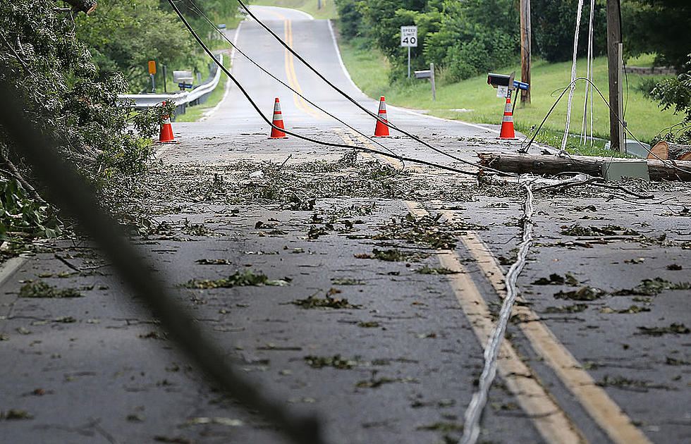
IMPACTS...Damaging winds will blow down trees and power lines. Widespread power outages are possible. Travel will be difficult, especially for high profile vehicles. -National Weather Service in Binghamton
Forecasters say winds will actually increase on Monday afternoon with the strongest winds occurring in the evening, through Monday night. The weather service meteorologists warms that people should avoid being outside near wooded areas with trees and branches. Forecasters also warn that winds can cause hazardous driving conditions, especially for high-profile vehicles such as trucks and SUVs.
National Grid is also warning customers that high winds can result in downed power lines and power outages. At 11 a.m., the regions power company released the following statement: We’re increasing our field force, extending evening and overnight work shifts and closely monitoring the weather forecast that calls for wind gusts up to 60 mph across portions of central and eastern New York. Our crews are at the ready if the storm impacts service. We recommend keeping flashlights and extra batteries at home and keeping mobile devices fully charged so you can stay connected in the event of an outage.
The National Weather Service has also issued a Wind Chill Warning for Monday night between midnight and 10 a.m. Tuesday. Dropping temperatures combined with high winds and snow could make temperatures feel as cold as 10 to 20 below zero.
TIPS: Here's how you can prepare for power outages
More From WIBX 950
