
Spring? Old Man Winter Bringing Record Low Temps & Snow to CNY
Move over Mother Nature. Old Man Winter isn't done just yet. He's bringing a polar vortex to Central New York that'll feel more like January than the last week of March.
March is the worst month of the year in the Northeast. It may say spring on the calendar, but everyone in Central New York knows the season doesn't arrive until late April or even May. There are a few nice days out of the month to tease you. But winter always returns to smack you in the face.
Cold & Snow Coming
Colder air will move into the region with possible record low temperatures dropping to 20 degrees below average, according to the National Weather Service. If that's not bad enough, lake effect snow showers are expected too. Most will be across the northern Finger Lakes Region and the southern Tug Hill Plateau. Several inches are possible Saturday night through Sunday night in Northern Oneida, Onondaga, Madison, and Southern Oneida Counties.
Saturday temperatures will struggle to hit the freezing mark. Sunday will be even colder with highs only in the low to mid-20s.
Forecasted highs on Sunday are around the record low maximum for the day though forecasted lows both Saturday and Sunday are just above the records.

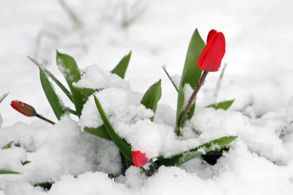
Protect Plants
If you have started outdoor gardens, the National Weather Service suggests you cover tender plants and bring any potted plants indoors.
"The good news is this will likely be the last arctic airmass of the season."
Things will start to warm up on Tuesday, with temperatures just above the freezing mark. It'll be in the mid-40s on Wednesday and reach 60 by Thursday. Let's just hope it only gets nicer from there.

NWS Extended Forecast
Friday: Showers likely, mainly after 4 pm. Mostly cloudy, with a high near 50.
Friday Night: Showers likely before midnight, then a slight chance of showers after 3 am. Mostly cloudy, with a low around 35.
Saturday: A chance of rain and snow showers before 9 am, then rain showers likely. Mostly cloudy, with a high near 45. Little or no snow accumulation is expected.
Saturday Night: A chance of rain showers before 10 pm, then a chance of rain and snow showers between 10 pm and 2 am, then snow showers likely after 2 am. Mostly cloudy, with a low around 29. West wind 8 to 10 mph.
Sunday: Snow showers likely, mainly before 2 pm. Mostly cloudy, with a high near 33.
Sunday Night: A chance of snow showers. Mostly cloudy, with a low around 14.
Monday: A chance of snow showers. Mostly cloudy, with a high near 24.
Monday Night: Partly cloudy, with a low around 14.
Tuesday: Mostly sunny, with a high near 34.
Tuesday Night: Mostly clear, with a low around 19.
Wednesday: A chance of rain and snow showers. Partly sunny, with a high near 45.
Wednesday Night: A chance of rain and snow showers. Mostly cloudy, with a low around 37.
Thursday: A chance of showers. Mostly cloudy, with a high near 61.
20 Sure Signs Spring is Near in CNY
Mother Nature Proves Power By Pushing Ice Onto CNY Shore in Spring Phenomenon
Gallery Credit: Credit - Polly McAdams
More From WIBX 950


